Jump to navigation
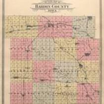
Plat Book of Hardin County, Iowa, 1903
1903
Gardner Map & Atlas Company
Gardner Map & Atlas Company, 1903, Plat Book of Hardin County, Iowa
Missing page 36-37, Map of the United States
English
1900-1910
United States
Iowa
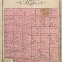
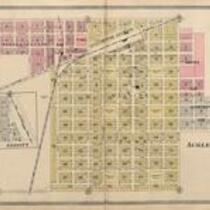
Hardin County
1 atlas: b&w: 40 x 45 cm.
State Historical Society of Iowa (Iowa City)
Scanned with Zeutschel OS12000 at 300 dpi, full color. Archival tiff available.
2011-12-09
Material in the public domain. No restrictions on use.
Contact the University of Iowa Libraries Map Collection: http://www.lib.uiowa.edu/sc/contact/ or Contact the State Historical Society of Iowa: libraryst@uiowa.edu
Still image Text
plats (maps) title pages indexes (reference sources)
jp2