Jump to navigation
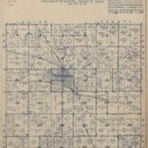
Atlas of Henry County, Iowa, 1931
1931
Kean Map Co.
Kean Map Co., 1931, Atlas of Henry County, Iowa
English
1930-1940
United States
Iowa
Henry County
1 atlas: b&w: 31 x 39 cm.
State Historical Society of Iowa (Iowa City)
Scanned with Zeutschel OS12000 at 300 dpi, full color. Archival tiff available.
2012-02-17
No known copyright restrictions.
Contact the University of Iowa Libraries Map Collection: http://www.lib.uiowa.edu/sc/contact/ or Contact the State Historical Society of Iowa: libraryst@uiowa.edu
Text Still image
title pages indexes (reference sources) plats (maps)
jp2