Jump to navigation
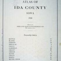
Atlas of Ida County, Iowa, 1920
Midland Map Co.
Midland Map Co., 1920, Atlas of Ida County, Iowa
English
1920-1930
United States
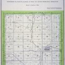
Iowa
Ida County
1 atlas: b&w: 32 x 39
State Historical Society of Iowa (Iowa City)
Photographed with Nikon D300 digital camera; Lighting was produced by 6 x 27 watt compact fluorescent bulbs @5100K full spectrum color temperature; Images optimized for color in Adobe Photoshop Elements.
Material in the public domain. No restrictions on use.
Contact the University of Iowa Libraries Map Collection: http://www.lib.uiowa.edu/sc/contact/ or Contact the State Historical Society of Iowa: libraryst@uiowa.edu
Still image Text
advertisements maps (documents) plats (maps) title pages
jp2