Jump to navigation
About
Browse Collections
Advanced Search
Contact
The University of Iowa Libraries
Select Collection
African American Women in Iowa Digital Collection
All collections
Anthropology at Iowa
Arthur and Miriam Canter Rare Book Room
Book Arts in Special Collections
Book Model Collection
Calvin Geological Photographs
Capture Your Research
Civil War Diaries and Letters
Council on Disability Awareness Publications
Dada Digital Collection
Dennis Michael Warren Slide Collection
Dentistry College Class Photographs
Department of Theatre Arts Design Portfolios
Dutch in the World
Early Manuscripts Digital Collection
Editorial Cartoons of Brian Duffy
Editorial Cartoons of Frank Miller
Editorial Cartoons of Harold "Tom" Carlisle
Editorial Cartoons of J.N. "Ding" Darling
Eve Drewelowe Digital Collection
Evelyn Birkby Collection
Fan Fiction Oral History Project
Félix de la Concha’s Portraits in Conversation
Figge Art Museum Grant Wood Digital Collection
Filmed/Virtual Gallery
Fluxus West Digital Collection
General Land Office Survey Maps
Geoscience Slides
Glenister Geoscience Slides
Grant Wood Art Colony
Hancher Auditorium Events
Helen Grundman 4-H Scrapbook
Henry A. Wallace Collection
Hevelin Fanzines
Historic Iowa Children's Diaries
Historic Sheet Music Digital Collection
History Corps Archive
Hixson Plat Map Atlases of Iowa
Homer Calkin Slides
ILA/ACRL Annual Reports
ILA/ACRL Business Meetings
ILA/ACRL Chapter Reports
ILA/ACRL Minutes and Reports
ILA/ACRL Strategic Plans
ILA/ACRL Treasurer's Reports
ILA/ARCL Board Minutes
Ignaz Pleyel Early Editions
Imogene Hub Newsletter
International Programs Outreach Culture Kits
Iowa Aerial Photo Indices
Iowa Byington Reed Diaries
Iowa City Foreign Relations Council Presentations
Iowa City Independent Publishing
Iowa City Town and Campus Scenes
Iowa Historic Sheet Maps
Iowa Journalists Oral Histories
Iowa Labor History Oral Project
Iowa Narratives Project
Iowa Poetry Prize
Iowa River Collection
Iowa Towns
Iowa Women's Archives Founders
Iowa Women's Archives Images
Irving Weber's Iowa City
James Van Allen Papers
James W. Bollinger Collection
John Martin Rare Book Room Images
John Martin Rare Book Room Presents
John P. Vander Maas Railroadiana
Journals of Historic Railroad Orders
Keith/Albee
Latino-Native American Cultural Center Digital Collection
Leigh Hunt Letters
Levi O. Leonard Railroadiana
Madurese Storyteller Videos
Manuscript Collection
Media Fan Oral History Project
Michael W. Lemberger Political Photographs
Mildred Wirt Benson Collection
Morris Family Papers Digital Collection
Mujeres Latinas Digital Collection
Museum of Natural History Egg Cards
Nicholas Johnson collection
Nile Kinnick Digital Collections
Noble Photographs
Office of the State Archaeologist Publications
Paleontology Archives at the University of Iowa
Paleontology Repository at the University of Iowa
Paper Through Time: Specimens Tested
Patrobas Cassius Robinson Digital Collection
Pioneer Lives
Rand & Leopold Desk Company Catalogs
Research Collections Images
Rural Women Digital Collection
Scenic Design Gallery
School of Art & Art History Graduate Archive
School of Art and Art History Resources
Science Fiction Fandom
Scottish Highlanders Collection
Social Justice in Iowa
Soteriou Papermaking Images Archive
Springer Printing Ephemera
Szathmary Culinary Manuscripts and Cookbooks
Szathmary Recipe Pamphlets
The Darwin Turner and Afro-American Institute Collection
The University of Iowa End of Session Class Counts
The University of Iowa Libraries Administrative and Public Relations Material
The University of Iowa Tuition and Fees
Top-level Collection
Traveling Culture: Circuit Chautauqua in the Twentieth Century
U.S. Government Posters
UIMA Collection
University of Iowa
University of Iowa Alumni Publications
University of Iowa Art Festival Programs
University of Iowa Campus Maps
University of Iowa College of Medicine Historical Photographs
University of Iowa Commencement Programs
University of Iowa Coral Specimens
University of Iowa Coral Tissues
University of Iowa Digital Books Collections
University of Iowa General Catalogs
University of Iowa Graduation and Retention
University of Iowa History of Medicine Lectures
University of Iowa Main Library Gallery
University of Iowa Museum of Natural History Images
University of Iowa Office of the Registrar
University of Iowa Physical Education for Women
University of Iowa Press
University of Iowa School of Music Recordings Archive
University of Iowa Summary of Degrees Granted
University of Iowa Yearbooks
Victor Animatograph Company Pamphlets
Victorian Trade Cards
Virtual Writing University Archive
W9XK Experimental Television at Iowa
Woman's Christian Temperance Union of Iowa
Women's Movement in Iowa
Women's Suffrage in Iowa
World War I Diaries and Letters
World War II Diaries and Letters
World War II Iowa Press Clippings
Young Lords Organization Newsletters
cARTalog
Search box
You are here
Home
›
iowa
(x)
Search results
1 to 48 of 135726 Objects
Sort By:
Relevance
Date
Sort by Title
Pages
1
2
3
4
5
…
next ›
last »
Iowa City comprehensive plan land use update, 1983
Iowa
Iowa
Iowa
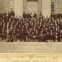
Law class of 1879 on steps of Old Capitol, The University of Iowa, 1879
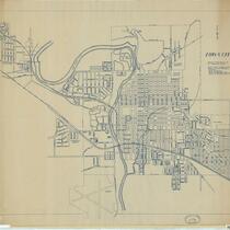
Iowa City, 1947
Iowa City comprehensive plan: 1989 update
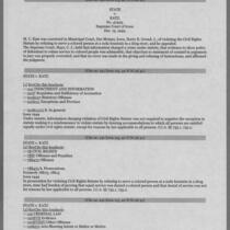
State v. Katz, 1949
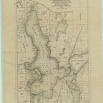
Map of West Okoboji Lake ... Dickinson County, Iowa: to accompany the report on Iowa lakes and lake beds, 1916
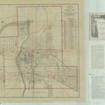
Map of the city of Cedar Rapids and town of Kenwood Park, Iowa: showing streets, parks, public buildings, etc., 1916
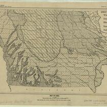
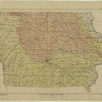
Map of Iowa: map showing the surface distribution of the five drift sheets in Iowa, 1928
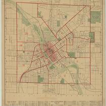
Map of the city of Iowa City, Iowa: showing streets, parks, public buildings, etc., 1910
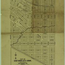
Map of East Iowa City, Iowa as platted by W.F. Main Co., 1898
Map of Iowa showing drift sheets, 1917
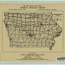
Iowa road map showing condition, January 1, 1925
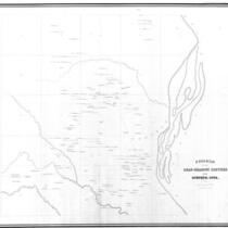
Diagram of the Lead-Bearing Crevices near Dubuque, Iowa, 1858
Diagram of the Lead-Bearing Crevices near Dubuque, Iowa, 1858
Iowa City comprehensive plan, 1997
Iowa City comprehensive plan: adopted May 30, 1978
Proceedings of the Iowa state colored convention held in the city of Des Moines, February 12th and 13th, 1868
United Campus Ministry papers, 1970-1972
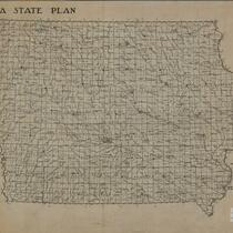
Map of Iowa communities: combination of interest areas found by Iowa State Planning Board 1932-1934: map of Iowa
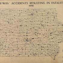
Highway accidents resulting in fatalities, 1936: state of Iowa
Iowa City Shelter House community stories Writers' Workshop reading, Live from Prairie Lights, May 31, 2012
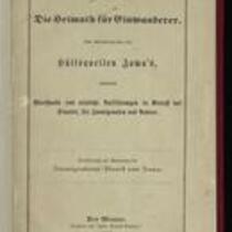
Iowa, die heimath für einwanderer: Eine abhandlung über die hülfsquellen Iowa's, enthaltend werthvolle und nützliche aufklärungen in betreff des staates, für immigranten und andere, 1870
Iowa Equal Suffrage Association flyers, 1916
Iowa suffrage leaflets, 1910s
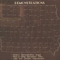
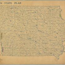
Demonstrations: map of Iowa
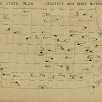
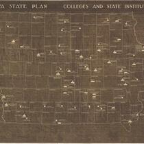
Colleges and state institutions: Iowa
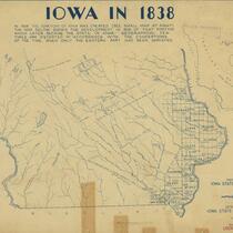
Iowa in 1838
The Mississippi Parkway through Iowa
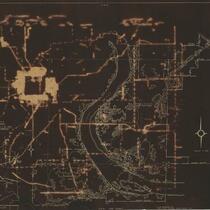
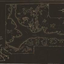
SP-1, Palisades Kepler State Park
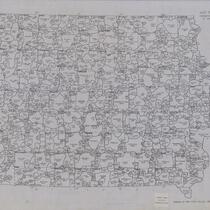
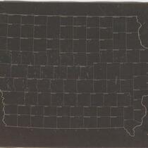
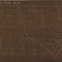
Iowa base map showing towns, townships, and rivers
SP-17, Backbone State Park
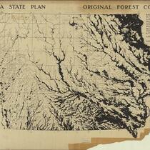
Original forest cover: Iowa: based on data secured in the original land survey made in Michigan, Wisconsin, and Iowa territories, 1832-1859
SP-18, Ahquabi State Park
Iowa map showing historical points of interest
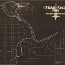
Cedar Falls, Iowa
SP-19, Mc Bride State Park
Map of Iowa
Iowa map showing state parks, wild life preserves, and forests
Colleges and state instituttions: Iowa
Iowa base map
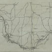
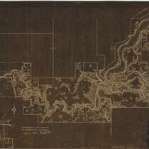
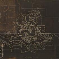
Canoe trails of Iowa. Des Moines River
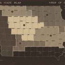
Yield of oats: average yield of oats by districts: 5 year average 1928-1932
Planning a better community
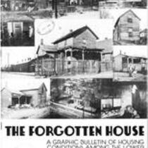
Forgotten house : a graphic bulletin of housing conditions among the lower income groups in Iowa
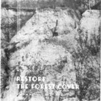
Restore the forest cover: a graphic brochure
Pages
1
2
3
4
5
…
next ›
last »