Search results

1 to 38 of 38 Objects
Topographies of the typical Iowa Drift Plain and the dissected Kansan Drift Plain, west of Washington near Van Horne, Iowa, late 1890s or early 1900s
Kansan section showing Peorian loess on Kansan gumbotil, oxidized and leached till, ox, and unleached till, Oregon Township, Iowa, August 1933
Panorama of Kansan section of Peorian loess on Kansan gumbotil shown in Neg. 7441, Oregon Township, Iowa, August 1933
Kansan gumbotil overlain by Peorian loess, Oregon Township, Iowa, August 1933
Washington County, Iowa, 1957, aerial photomosaic index
Washington County, Iowa, 1951, aerial photomosaic index
Washington County, Iowa, 1963, aerial photomosaic index
Washington County, Iowa, 1937, aerial photomosaic index
Washington County, Iowa, 1969, aerial photomosaic index
Washington County, Iowa, 1976, aerial photomosaic index
Washington County, Iowa, 1978, aerial photomosaic index
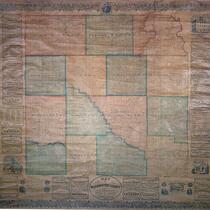
Map of Washington County, Iowa, 1859
Plat book of Washington County, Iowa, 1930
Map of Washington County, Iowa, 1859
Atlas of Washington County, Iowa, 1906
South Washington, Iowa. CRIP
Washington, Iowa. CRIP
Brighton, Iowa. MSTL
Washington, Iowa. MILW
Kalona, Iowa. CRIP
Kalona, Iowa. CRIP
Rubio, Iowa. MILW
Rubio, Iowa. MILW
Haskins, Iowa. MILW
Haskins, Iowa. MILW
Westchester, Iowa. CRIP
Wellston, Iowa. MILW
Crawfordsville, Iowa. CBQ
Riverside, Iowa. CRIP
Brighton, Iowa. CRIP
Wellman, Iowa. CRIP (now CI)
Washington, Iowa. MILW
Ainsworth, Iowa. CRIP
Wellman, Iowa. CRIP
Wellman, Iowa. CRIP
Brighton, Iowa. CNW
Brighton, Iowa. CNW
Rubio, Iowa. MILW
Rubio, Iowa. MILW
Washington, Iowa. CBQ
Titus, Iowa. MILW
Titus, Iowa. MILW
Rubio, Iowa. MILW
Rubio, Iowa. MILW
Haskins, Iowa. MILW
Haskins, Iowa. MILW
Washington, Iowa. CRIP