Search results

1 to 48 of 2071 Objects

Pages

A new map of the state of Iowa, 1850
Allen's outline map of Ottumwa, Iowa, 1891
A township map of the state of Iowa, 1851
Iowa, 1847
Iowa, 1847
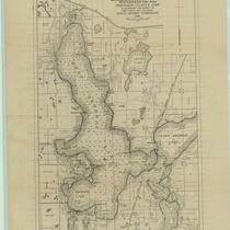
Map of West Okoboji Lake ... Dickinson County, Iowa: to accompany the report on Iowa lakes and lake beds, 1916
State of Iowa, 1878
State of Iowa, 1878
Map of the surface deposits of Polk County, Iowa, 1897
Iowa, 1859
Iowa, 1859
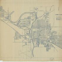
Iowa City, Iowa, 1906
Map of Hancock County, Iowa, 1910
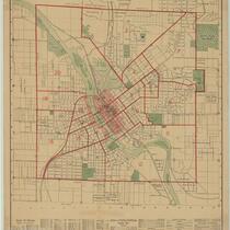
Map of the city of Cedar Rapids and town of Kenwood Park, Iowa: showing streets, parks, public buildings, etc., 1916
Map of part of the Wisconsin Territory: compiled from Tanner's map of U. States, from surveys of public lands and Indian boundaries, from personal reconnoissance and from original information derived from explorers and traders, 1935
Iowa, 1846
Iowa, 1846
Map of Monticello, Jones Co., Iowa, 1864
Iowa City and its environs, 1854
Map of the city of Clinton, Clinton Co., Iowa, 1892
Iowa, 1858
Iowa, 1858
The campus of the State University of Iowa, 1930
Official map of Benton County, Iowa: showing primary, county, and township roads and school districts, 1925
Sketch of the public surveys in Iowa, 1855
Iowa, 1843
Iowa, 1843
Wisconsin, 1846
Wisconsin, 1846
Iowa's electric transmission lines and plants, 1927
State of Iowa, 1912
State of Iowa, 1912
Iowa, 1875
Iowa, 1875
Map of Polk County, Iowa, 1878
Iowa City, 1947
Iowa City, 1947
Sketch of the public surveys in Iowa, 1848
Map of Iowa: showing towns with their location and population, railroads, counties, and congressional districts, 1901
Iowa, 1858
Iowa, 1858
Survey of the Mississippi River, Chart 144, 1891
Iowa, 1855
Iowa, 1855
Posting map, State of Iowa, 1905
Percent forest and waste lands
Forest purchase areas: purchase areas for proposed national forests
1929 tax delinquency: percentage of total acres by townships on which 1929 taxes were delinquent
1931 tax delinquency: percentage of total acres by townships by which 1931 taxes were delinquent
1930 tax delinquency: percentage of total acres by townships on which 1930 taxes were delinquent
1928 tax delinquency: percentage of total acres by townships on which 1928 taxes were delinquent
Rural secondary schools: Iowa: spot map showing location of rural, consolidated, urban schools
Public & association libraries: Iowa
Water supply situation: Iowa
Precipitation stations: Iowa: locations of stations maintained by the U.S. Weather Bureau
Sewage disposal situation: Iowa
Drainage basins: areas drained by principal Iowa rivers
Des Moines-Skunk River basins: showing location of basins with respect to state principal drainage lines within area
Feed unit production: feed units produced per acre of total land in farms: by townships
Township map, proposed national monument, Clayton-Allamakee Counties, Iowa

Pages