Search results

1 to 48 of 75 Objects

Pages

Lime quarry, Cedar Valley, Iowa, late 1890s or early 1900s
Topography of Iowan Drift area, Massilon Township, Iowa, July 18, 1925
Paha, Stanwood, Iowa, late 1890s or early 1900s
E.J.C. Bealer's Quarry, Cedar Valley, Iowa, late 1890s or early 1900s
Pebble band on Iowan till, Fremont Township, Iowa, July 8, 1924
Wind-polished boulder west of Stanwood, Iowa, July 2, 1925
Man standing near oblique bedding at Sugar Creek lime quarries, Sugar Creek, Iowa, late 1890s or early 1900s
Oblique bedding at Sugar Creek lime quarries, Sugar Creek, Iowa, late 1890s or early 1900s
Bealer Quarry, Cedar Valley, Iowa, late 1890s or early 1900s
Pebble band on Iowan till, Fremont Township, Iowa, July 8, 1924
Lime quarry, Cedar Valley, Iowa, late 1890s or early 1900s
Bealer Quarry, Cedar Valley, Iowa, late 1890s or early 1900s
Iowan Drift area topography, Massilon Township, Iowa, July 18, 1925
Kansan gumbotil with Iowa topography in the background, Massilon Township, Iowa, July 18, 1925
Typical Kansan topography, Tipton, Iowa, late 1890s or early 1900s
Bealer Quarry, Cedar Valley, Iowa, late 1890s or early 1900s
Niagaran Lime quarry, Sugar Creek, Iowa, late 1890s or early 1900s
Man standing by oblique bedding in Sugar Creek lime quarries, Sugar Creek, Iowa, late 1890s or early 1900s
Anamosa Stage, Cedar Bluff, Iowa, late 1890s or early 1900s
E.J.C. Bealer's Quarry, view looking down the river, Cedar Valley, Iowa, late 1890s or early 1900s
Undercutting of Gower limestone on Wapsipinicon River, Massillon, Iowa, late 1890s or early 1900s
Bealer Quarry, Cedar Valley, Iowa, late 1890s or early 1900s
Iowa land survey map of t080n, r003w
Iowa land survey map of t081n, r001w
Iowa land survey map of t080n, r002w
Iowa land survey map of t082n, r001w
Iowa land survey map of t081n, r004w
Iowa land survey map of t079n, r003w
Iowa land survey map of t080n, r004w
Iowa land survey map of t081n, r003w
Iowa land survey map of t082n, r003w
Iowa land survey map of t082n, r002w
Iowa land survey map of t079n, r001w
Iowa land survey map of t082n, r004w
Iowa land survey map of t079n, r002w
Iowa land survey map of t079n, r004w
Iowa land survey map of t081n, r002w
Iowa land survey map of t080n, r001w
Cedar County, Iowa, 1940, aerial photomosaic index
Cedar County, Iowa, 1951, aerial photomosaic index
Cedar County, Iowa, 1936, aerial photomosaic index
Cedar County, Iowa, 1963, aerial photomosaic index
Cedar County, Iowa, 1969, aerial photomosaic index
Cedar County, Iowa, 1979, aerial photomosaic index
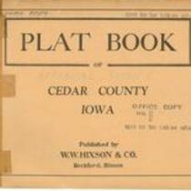
Plat book of Cedar County, Iowa, 1930
Atlas of Cedar County, Iowa, 1901
Tri-County Farmers Institute Atlas: Covering Parts of Scott, Muscatine, and Cedar Counties, Iowa, 1921
Atlas of Cedar County, Iowa, 1916

Pages