Search results

1 to 48 of 70 Objects

Pages

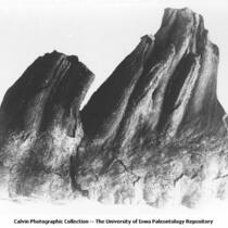
Pleistocene Fauna, left upper 6th molar of Mammut mirificum Leidy, Mastodon mirificus Leidy, dug through Kansan Drift, about 5/6 natural size, worn, Mr. Jensen's farm, Afton, Iowa, late 1890s or early 1900s
Bluffs of Kettle Creek, Millersville, Iowa, late 1890s or early 1900s
Chalk cliff near Old Grills Mill on Sioux River south of Westfield, Iowa, 1890s
Pleistocene Fauna, right upper 6th molar of Mammoth mirificum Leidy, Mastodon mirificum Leidy, reached in digging well through Kansan Drift on Mr. Jensen's farm near Akron, Iowa, late 1890s or early 1900s
People near Dakota and Benton formations near Old Crills Mill on Sioux River below Westfield, Iowa, late 1890s or early 1900s
People near Dakota and Benton formations near Old Crills Mill on Sioux River below Westfield, Iowa, 1890s
Pleistocene Fauna, side view of well worn molar, 6th superior, right side, Mastodon mirificus Leidy, from well (well went down through Kansan Drift), Akron, Iowa, late 1890s or early 1900s
Standard historical atlas of Plymouth County, Iowa 1907
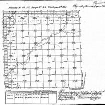
Iowa land survey map of t091n, r048w
Iowa land survey map of t092n, r046w
Iowa land survey map of t092n, r049w
Iowa land survey map of t093n, r044w
Iowa land survey map of t093n, r046w
Iowa land survey map of t090n, r048w
Iowa land survey map of t092n, r048w
Iowa land survey map of t090n, r047w
Iowa land survey map of t091n, r047w
Iowa land survey map of t091n, r049w
Iowa land survey map of t092n, r043w
Iowa land survey map of t091n, r046w
Iowa land survey map of t092n, r044w
Iowa land survey map of t090n, r043w
Iowa land survey map of t092n, r047w
Iowa land survey map of t091n, r043w
Iowa land survey map of t093n, r049w
Iowa land survey map of t091n, r049w
Iowa land survey map of t093n, r048w
Iowa land survey map of t093n, r047w
Iowa land survey map of t090n, r046w
Iowa land survey map of t090n, r044w
Iowa land survey map of t093n, r043w
Iowa land survey map of t091n, r044w
Plymouth County, Iowa, 1938, aerial photomosaic index
Plymouth County, Iowa, 1962, aerial photomosaic index
Plymouth County, Iowa, 1955, aerial photomosaic index
Plymouth County, Iowa, 1949, aerial photomosaic index
Plymouth County, Iowa, 1968, aerial photomosaic index
Plymouth County, Iowa, 1972, aerial photomosaic index
Plymouth County, Iowa, 1978, aerial photomosaic index
Plat book of Plymouth County, Iowa, 1930
The LeMars semi-weekly sentinel sectional pocket map of Plymouth County, Iowa, with comprehensive statistics, 1891
Plat book of Plymouth County, Iowa, 1930
Atlas and Farm Directory with Complete Survey in Township Plats of Plymouth County, Iowa, 1914
Atlas of Plymouth County, Iowa, 1921
Hinton, Iowa. CCP
Hinton, Iowa. CCP
West Le Mars, Iowa. GN
Le Mars, Iowa. CCP
Le Mars, Iowa. CCP
Hinton, Iowa. BN
Hinton, Iowa. BN

Pages